Welcome Intrepid Readers and fellow Skippers to a time honored Maine tradition accomplished this past week by your favorite Sea Pearl 21 and her surly crew-- the Circumnavigation of Sebascodegan ("Great") Island!
 |
NOT FOR NAVIGATION
get your own damn chart!
NOAA |
I'm not going to pansyfoot around the proverbial bushes: The Sebascodegan Circumnavigation is a beautiful must-do cruise for any small boaty type person and I am happy to say I hope to repeat this little adventure in the future with friends (calling Cap'n Jon! calling CCBB! AWWOOOOOGA). From a little bit of ocean (not too much) to quiet upper waterways and small channels, low bridges, and friendly eagles, this was a great, great trip! Hooray greatness!
I have mapped my journey with
NOAA Chart Viewer (for the chart) and my memory. Hence, tacking is approximate and dawdling around looking at things and/or making big decisions is not shown. As most here know, I eschew GPS and other devices for map and compass so no fancy-pants internet tracks. Sorry tech-weenies, I spend my money and time on other things, like getting lost in the fog (worry not: did not happen this journey). Also, I am sadly missing pictures of sweet sailing on the first day, as I left my camera at home and only decided to use my cell phone after I picked the island to camp. Apologies to all, and sorry about the less-than-stellar quality of the pictures.
DAY ONE
I started somewhat late, about 4pm, from Bethel Point. There is a ramp there, with parking at Bethel Point Marine nearby. LOW POWER LINES ABOUND. DO NOT STEP MASTS EARLY. Very friendly little place, if no one is available to leave your money on the honor system (6$ per day), there is a box. This is Maine at it's finest. Don't screw it up!
 |
DAY ONE 4pm-Late Evening
black: mark start/stop
red: somewhat accurate rendering of motion |
Since this was the first real cruise of the season I launched in a predictable discombobulated mess and drifted for a while as I attempted to take stock. A powerboater asked if I needed a tow, probably not because I was rowing but because I looked like a menace with a pile of gear haphazardly strewn around the boat and me wandering around frantically looking for my tiller extension. At some point I managed to get the masts up and I found my tiller extension to my great relief--
no Cap'n Jon repeats here. With a somewhat slack tide and a strong headwind I beat down Quahog Bay, harboring dreams of staying ahead of the 30' sailboat beating down behind me. I held my own but finally we were passed ("Pretty boat!" they hailed) and he charged southward, only to turn around and sled back north. I continued around Gun Point snaking around underwater obstacles and settled in for a dream like wing-and-wing downwind run up to the top of Gun Point Cove.
During this run I admired the scenery and solitude for I was alone with quiet summer houses still in off-season slumber. At one point a powerboat came charging up from behind me to ask me, "Is this New Meadows [River]?" ... Intrepid Reader, can check chart above for yourself. I told them they were at least two over and they bounded back before I could even read them a Can number for the entrance to New Meadows River. Save your gas, buds.
At the top of the Gun Point Cove is a small bridge, with not much vertical or horizontal clearance. I took down the masts and started to row through. It's quite picturesque with steep sided rock walls on either side and a narrow channel. The current had turned and was starting to flow through, I'm sure she rips right through here, fortunately it was still a little slack. There was a lobster boat coming through with some tour on board and lots of leering land-folk who gave off somewhat presumptuous airs. The Cap'n and I yelled at each other a bit about how we were doing and what I would like to believe was his first mate yelled "That's one big ass canoe to be rowing!" not to me, but to the Cap'n when maybe he thought I couldn't hear. I liked that line, because the Sea Pearl looks like a canoe, and yes it's a big ass canoe to be rowing and it almost sounded like I was getting some cred. Of course, I've got the cold Iron Mizzen hanging off the back like a lump of metal, I'm sure that garners the question marks and the "tourist" tag. That's ok, too.
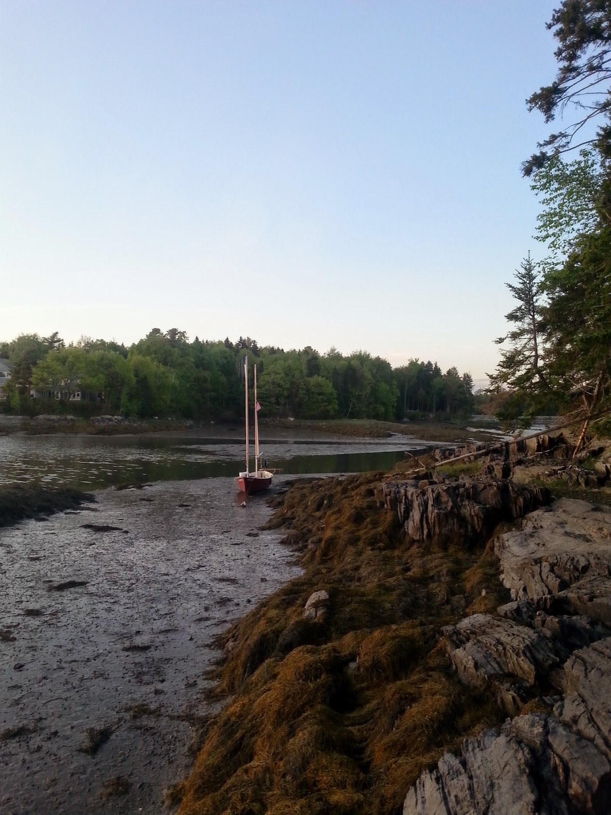
At the north end of Harpswell Sound I meandered around just south of the bridge (30' vertical clearance) as I fiercely debated with myself if I should park for the night at nearby Strawberry Creek or if we continued north and enjoy the sunset and beautiful wind. In the end, I decided to not continue up the Ewin Narrows and instead put in at Strawberry Creek Island. The water was rapidly drawing down (thank goodness for shallow draft... holy cow guys I was skimming across some bars) and I wanted to reconnoiter the island and the landing areas so I pulled out my trust grapnel, and threw it into the weed covered rocks for a quick hook to drag me into position. The result:
 |
This is what a Grapnel Anchor looks like in parts.
Carry a spare. |
I do not suggest throwing your anchor with fervor into the rocks. Scout and I were now mud bound. This was fine, except I had to check on anchoring, current, and wind multiple times during the night to ensure I didn't get
washed up on the rocks and then stuck high and dry the next day. Sleep was fitful at best, all for the want of a few extra minutes of water.
 |
| From Strawberry looking south down Harpswell Sound |
 |
| At least it's flat. |
DAY TWO
After getting considerably less sleep than I was wanting or needing, I woke up in time for my morning constitutional and with enough time to get off the island before I lost the tide again. I was not going to spend this beautiful day marooned on a mud flat. This meant that while I enjoyed the company of my bailing bucket, Double Doodie bag, and a constitutional on solid ground, I had to push Scout out into the open water, which is always a heart-in-mouth moment.
 |
| Strawberry Creek Island from the boat. Note new floorboards! |
 |
BOOM One more time:
Lt. Presto's amazing new addition to Scout, my stainless espresso maker! |
 |
Not the moment to be wondering if the bitter end is tied off.
This picture makes me proud. |
But all's well that is well tied off, and I collected Scout after my constitutional and we headed under the bridge for the Ewin Narrows.
 |
| DAY TWO 8am-Noon/Siesta/2pm-5pm |
The Ewin Narrows bridge is a cakewalk, over 100' of horizontal clearance and 30' of vertical, an easy pass for the Sea Pearl 21. Wing-and-wing Scout and I leisurely worked north up the narrows. The breeze was still that early-morning gentle, but it was enough to keep us moving at a rate that granted us good sightseeing without the dragging of feet. At the north end of the narrows we maneuvered between Doughty Island and Doughty Point. The island is private, but the point is a public-use preserve, and we took a quick stop there for a lay of the land.
 |
| The Doughty family cemetery. A cellar hole is apparently nearby, but I didn't go searching for it. |
 |
| Looking south into the Long Reach. We will be going north. |
 |
Scout on the beach at Doughty Point.
We'll be going around the corner in the upper right, left turn northbound. |
Northbound up the Long Reach at almost total low tide required staying in the channel. A quick look at the chart will indicate the massive mud flats that abound on either side. While they were not exposed, there wasn't enough to float Scout. I cut one corner a little close but a bit of scraping and a kicked up rudder later found us back in the channel.
 |
| This bad boy is called "Rights of Man" |
At the top of Long Reach is the Gurnet Straight, it's deep hole (90 feet!) and it's bridge (10 feet tall) and the fact that once the current gets going, it produces standing waves.
Standing waves. I did not know this at the time. And I am glad I did not know, because my mind would have been in even more tumult had I known. Timetables and the clock would have ruled the day. So I arrived at Gurnet Straight, characterized by some cottages, an old lobsterman's pile of traps, and the bridge.
 |
| It is deep here. |
 |
| The Bridge |
Down came the masts, and away I went, rowing to the bridge at Gurnet Straight. The current was flowing against me, and its velocity was increasing as we rowed. I could
see it increasing. Incredible. I hugged the south side (right in the picture) and Scout was promptly spun around, pinned against the rocks. I grabbed my trusty boathook and pushed us off and we were ejected from the maw of the angry bridge troll right back into the hole. I noticed some eddies on the north side (left) and I rowed again like a madman, pulling my 21' boat with my bare hands and we made it through. Wow. I can only imagine the story if I found the legendary standing waves. I either missed out on a nightmare or an adventure, or a little of both. Once clear of the straight, masts up and it was a short leisurely sail to Indian Island off Indian Point, a small public day-use island. Here, not wanting to fight the flood in the New Meadows River, I anchored in the small bay, watched horseshoe crabs (hordes of horseshoe crabs) set up an awning and promptly fell asleep.
 |
| Hot |
 |
New lunchtime snoozefest set up.
The dark green is warm. Just sayin'. |
Around 2pm I awoke in a fashion that can best be described as "slammed." I was hot, thirsty, tired, full of sleep momentum, confused, tired, fuzzy and probably damn irritable but since I was solo there was no one to be irritable too, which can be considered a waste of irritability.
The tide was full up and about to head out. The awning came down (again, green is warm. I need a new awning) and sails came out and Scout and I headed down the New Meadows River, southbound, on the east side of Sebascodegan Island. Destination unknown. With a strong breeze still blowing from the south Scout and I beat downriver, and though the tide was going out the current still had a bit of time before turning around. We made so-so headway and I explored a few small islands in the stream.
Finally, I came to a mental point where I just looked down to the ocean, two miles or more to the southern tip of Sebascodegan, felt the chill of the ocean air, the blowing wind, the high hazy semi-overcast, and was weighted down with oppression tinged with a bit of loneliness. This tacking back and forth in the cold in the wind with no appreciable progress south, alone, tired, and hungry made me want the day to be done. I was frazzled out, and my judgement skills were beginning to dull.
Fortunately, there was an option! It is called The Basin, and I was fortuitously abeam its entrance. With the current strongly against me and the wind now flukey in the entryway I fired up the Iron Mizzen for the first time this trip. She started first pull. Into The Basin we went where I found a small cove to throw down the hook. There was a bald eagle nest on a nearby island, and I watched Mother Eagle feed the chicks, I watched the chicks fight Big-Bad-Osprey, and after a quick dinner (with Mother Eagle sitting in a tree nearby preening herself) I was out like a light.
Note:
The Basin's Nature Conservancy's lands are day-use only, no camping (I was anchored in the water and slept aboard), but have nice walking trails and multi-use trails. It's a beautiful place. Please check it out, respect, and enjoy. What a gem!
 |
| Island with Bald Eagle nest. Give good distance and do not disturb! |
 |
| Quiet, little wind, little current, no rocks. One anchor down and done. Safety and much needed sleep. |
DAY THREE
Up and at 'em early to catch the tide out of The Basin. It was time to finish this Sebascodegan Circumnavigation. Scout and I motored out of The Basin back to the New Meadows River and set up sail. This was some fine sailing down New Meadows River, when the wind is fresh and the light beckons one to join the living and squeeze the day! Possibilities feel limitless and every part of the body crackles with "Alive! Alive! We woke up for one more day! One more glorious wonderful day!"
It was a good antidote to yesterday's teeth gnashing in the afternoon.
 |
| DAY THREE 7am to 830am or so... quick and dirty |
In one long close hauled tack, we almost made it to the tip of Sebascodegan... but didn't. Two tacks later, and we rounded East Cundy Point inside Rogue Island, around West Cundy Point and up Ridley Cove back up to Bethel Point!
 |
| Cundy's Harbor |
 |
| East Cundy's Point |
 |
| Quintessential Maine |
 |
| Bethel Point with slimy boat ramp. |
SEBASCODEGAN CIRCUMNAVIGATION COMPLETE
TIP-OLAS:
Boat wise is up to you, but it's a trip like this that reminds me of the value of small easily rowed boats with downwind sailing potential, like
Clint Chase's Drake. If you're facing a long upwind slog and the current is "meh" or worse, what a better option than to snug into the coast, find the eddies, and work windward? With quiet waters and lots of north/south waterways that will channel the prevailing winds, boats like Drake, the
Lillistone's Phoenix III, and other comparable boats will shine here. The Sea Pearl 21, of course, did admirably and it's shallow draft made it perfect for some spots, but if my weather or timing was off, it probably would have meant a lot more Iron Mizzen usage. Thoughts to ponder, my friends.
I strongly recommend the
MITA guide for more boat access points, camping, and day use areas along the way (you should join this most worthy organization), your own good charts, and a tide-book-- or at least know the tides, and of course weather information. A well timed journey with the right tides and winds could probably be undertaken in one long long June day-- but two is normal. Mine was three, but it was a late departure on the first day and an early ending on the third. Be ready for strong currents, boat traffic in the on-season, lobstering, and fog (I was spared). Also, this is a relatively populated area, just north of Portland. You will hear traffic, construction, dogs, people talking, jet traffic from Brunswick, and other noises of our common humanity of which we are all bound.
You could also see bald eagle chicks fighting off Ospreys, seal with their pups, and wide black night skies. Go git 'em, Tiger.